Coptrz | Why RTK - August 2023

PREMIUM POSITIONING

RTK LICENCE

GET YOUR FREE TRIAL

WHY GET AN RTK LICENCE?
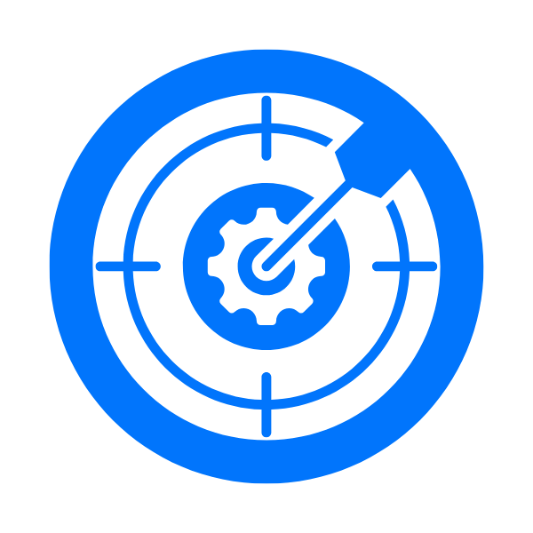
DATA ACCURACY

RTK technology significantly enhances the positional accuracy of your drone. With centimeter-level precision, RTK-enabled drones can provide more accurate data for various applications, such as mapping, surveying, and geospatial data collection. This level of accuracy is essential when working on projects that require detailed measurements or high-resolution imagery.

ENHANCED EFFICIENCY

RTK improves the overall efficiency in many professional applications. In surveying and mapping projects, the increased accuracy removes the need for ground control points, which can save time and resources. Higher precision also leads to fewer errors, reducing the need for rework or additional data processing, ultimately streamlining your workflow.

PROMOTED SAFETY

RTK GPD also shields against electromagnetic field and radio frequency interference. This type of interference typically occurs when aircraft fly close to radio towers, power lines and metal edifices. RTK can embrace electromagnetic interference without causing any interruption in your drone’s flight, preventing crashes or flyaways.


15 DAYS

FREE

FAQ'S

  • WHAT'S AN RTK LICENCE USED FOR?

    The primary benefit of RTK is its pinpoint location accuracy. RTK brings immense benefits for drone pilots as it enables them to get the pinpoint location of the UAV, which allows exact hovering in all conditions.


    Drones that feature RTK allow pilots to fly close to objects and operate in small spaces. RTK also provides the pilot with meticulous data, even when the aircraft is moving.


    Apart from location accuracy, RTK GPD also shields against electromagnetic field and radio frequency interference. This type of interference typically occurs when aircraft fly close to radio towers, power lines and metal edifices. EMF and RF frequency can disrupt your aircraft’s flight by forcing it to enter ATTI mode which will eventually lead to either a drone crash or flyaway.


    An RTK License is an ideal choice for enterprise pilots for industrial applications. Apart from protection, RTK is also helpful in geotagging the data captured by the aircraft that includes both video and images.


    The ultimate aim of RTK is to establish how many carrier waves there are between the antenna and the satellite. The reason for this is simple, each satellite broadcasts a unique C/A code made up of 1,023 bits. The code is sent at a rate of 1.023 Mb/s, which means one bit is sent about every microsecond. In one microsecond the radio signal from the satellite covers a distance of about 300 metres.

  • WHAT'S AN RTK DRONE?

    An RTK drone carries an onboard GNSS RTK receiver that gathers data from satellites and a stationary base (ground) station to more accurately correct image location, in real-time as it flies. The data from a ground station is factored in to correct satellite signal error, bringing accuracy down to cm (sub-inch)-level range – perfect for surveyors.


    In the case of RTK technology, uninterrupted communications are required from the GNSS base station, through the drone base station to the drone. When the drone lands, if all signals were constant, data with absolute accuracy is available for post-processing into mapping survey results.


    The RTK Base Station is comprised of an antenna, receiver and radio link to provide RTK correction signals to the auto-guidance system. Furthermore, the base stations can receive both GPS and GLONASS signals.


    Our National RTK Network includes 85 base stations around England, Scotland and Wales and utilises 4 GNSS collections. We like to make purchasing and utilising our network fast, simple and cost-effective.


    RTK requires four constant communication lines to correct satellite location data:


    1. The line between the satellites and the drone.

    2. The line between satellites and GNSS base. station or CORS (supporting VRS via mobile) network.

    3. The line between the GNSS base station or CORS/VRS and the drone base station, and 4. The line between drone base station and drone.

  • WHERE CAN RTK BE BENEFICIAL?

    RTK for Surveying and Mapping


    RTK is immensely beneficial for improving vertical accuracy while surveying stockpile. Using a combination of RTK and waypoints, accuracy in mapping and surveying can also be improved dramatically. Waypoints also create autonomous flights on pre-selected courses.


    RTK ensures that your drone remains on course both vertically and horizontally.


    RTK in Powerline Inspection


    Apart from the telecommunication industry, RTK has been massively beneficial in powerline inspection. It has promoted safety along with productivity. RTK can embrace electromagnetic interference without causing any interruption in your drone’s flight.


    RTK in Offshore Rig Inspection


    Apart from the telecommunication industry, RTK has been massively beneficial in powerline inspection. It has promoted safety along with productivity. RTK can embrace electromagnetic interference without causing any interruption in your drone’s flight.

GETTING AN RTK LICENCE SHOULDN'T BE FRUSTRATING

A Coptrz RTK license gives you a precise, real-time positioning method to enhance your operations and collect incredible data. We’re committed to ensuring you wow your clients , so we offer multiple RTK license options. 


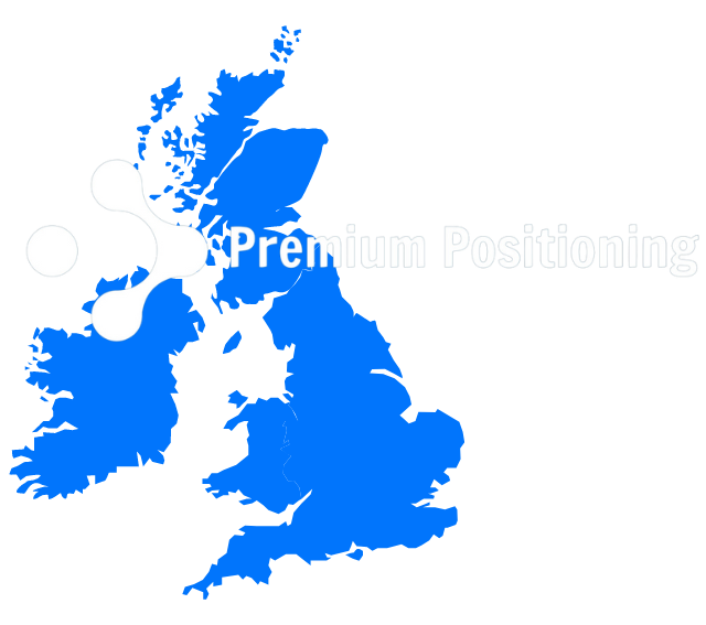
Our RTK Licenses are compatible with all types of machinery and equipment including Machine Control and the SmartRover to drones. Our National RTK Network includes 85 base stations around England, Scotland and Wales and utilises 4 GNSS collections. 

Share by: