Elevate Your Drone Piloting Skills with the Coptrz Flight Simulator
Welcome to the future of drone training with the Coptrz Flight Simulator. This innovative tool is designed to elevate your drone piloting skills, offering a realistic flight experience across a wide range of multi-rota drone models.
Immersive Yourself in an Authentic Flying Experience
THIS SOFTWARE TAILORED FOR THE ENTERPRISE ALLOWS YOU TO HONE YOUR PILOTING SKILLS WITHOUT THE POTENTIAL RISKS AND COSTS ASSOCIATED WITH REAL-LIFE TRAINING.
Three Flight Modes
Multiple POVs
Comprehensive Physics
Engine
Our Approach
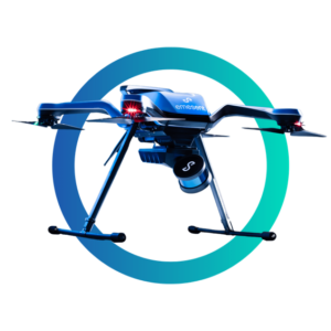
A NEW GENERATION OF AUTONOMOUS 3D MAPPING
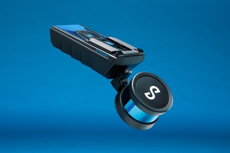
RUGGED DESIGN
The sleek, rugged design makes it simple to handle on walking scans and extends flight time when mounted on a drone.

IP65 RATED
The rugged, weather sealed design facilitates use in harsh conditions, removing dust, rain, snow and extreme temperatures as barriers to job completion.
EXPLORE BEYOND LINE OF SIGHT
Tap-to-fly autonomy function facilitates the mapping of formerly unreachable areas beyond visual line of sight (BVLOS). The omnidirectional Collision Avoidance, Guided Exploration, and intelligent Return-to-Home capabilities ensure that Hovermap ST maintains a safe distance from assets and securely returns home with the acquired data.

SURVEY-GRADE DATA
Hovermap ST’s world-leading SLAM technology and Emesent’s Automated Group Control feature allows you to capture dense, shadowless, survey-grade point clouds.
WHY CHOOSE HOVERMAP ST?
GO BEYOND
The advanced autonomy of Hovermap ST permits flight and mapping in tough circumstances, such as beyond visible line of sight and communication range, as well as in GPS-devoid surroundings. Send a Hovermap ST enabled drone to explore and map previously inaccessible locations while you remain in a secure location to gain fresh and important insights.
SURVEY-GRADE DATA
Precision engineering, world-class SLAM (Simultaneous Localization and Mapping), and Automated Ground Control produce dense, shadowless, survey-grade point clouds of an entire asset with Hovermap ST. Ground Control additionally georeferences point clouds to survey control automatically.
RUGGED DESIGN
Built to withstand dust and water, Hovermap ST is IP65 rated. This means that no matter what the conditions, rain or shine, you’ll be able to complete your mapping missions. An operational envelope of -10 to 45°C, and ability to operate in humidity conditions, makes the Hovermap ST a go-to tool for underground mines and other harsh environments.
PLUG-AND-PLAY
The Hovermap ST's plug-and-play functionality and quick-release mechanism allow for a rapid transition from drone-mounted to handheld scanning. This feature, alongside its lightweight and compact design, permits the efficient mapping of any environment.
Tap-To-Fly
Autonomy
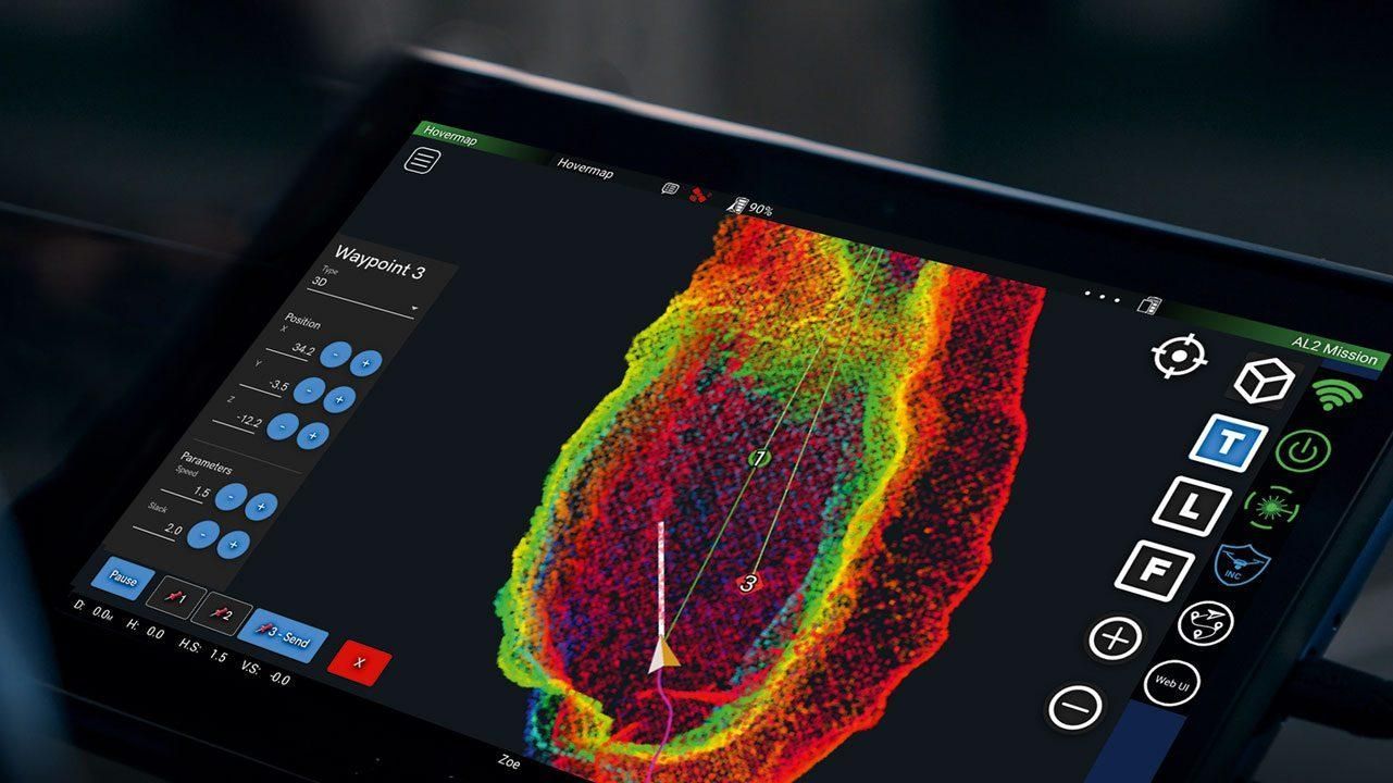
With Autonomous Waypoint Mode, pilots can complete an entire mission on a tablet, from takeoff to landing. Tap-to-Fly is a feature of the Hovermap ST that enables exploration in previously inaccessible locations beyond line of sight and communication range, providing access to previously unattainable insights. The functions of omnidirectional Collision Avoidance, Guided Exploration, and intelligent Return-to-Home ensure that assets are protected, and important equipment is not lost or damaged.
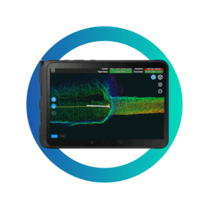
When in communication range, Hovermap ST feeds a live point cloud to the Hovermap app, delivering a real-time glimpse of the data as it is recorded. Enabling you to leave the location with the assurance that you’ve captured everything necessary.
AUTONOMY LEVELS
MAPPING MODE
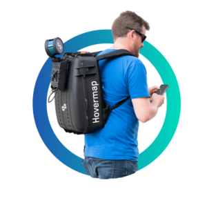
Mapping Mode provides rapid, precise, and high-resolution mobile scanning in areas where drone autonomy is unnecessary. For SLAM-based mobile mapping, the Hovermap ST's quick-release mechanism makes it simple to move from a drone to handheld scanning or a backpack, vehicle, or protective shaft scanning cage-mount.
PILOT ASSIST MODE
Pilot Assist Mode offers omnidirectional Collision Avoidance, GPS-denied flight capability, and stability control, providing the confidence and stability necessary for close, comprehensive inspections. It serves as a protective bubble for your drone, safeguarding both the asset and your equipment.
AUTONOMOUS WAYPOINTS
Through Smart Waypoints and Guided Exploration, Autonomous Waypoint Mode enables flight beyond line of sight. Tap the map to set intelligent waypoints, and Hovermap ST takes care of the rest, navigating to the waypoints, mapping the environment, and avoiding obstructions while keeping itself and the drone safe.
We are revolutionising organisations using drones.


Find Us
1st Floor
Phoenix House
Leeds
LS1 5QX
United Kingdom